Accuracy of drone data
A common misconception is that the imagery captured by drones can quickly and easily produce high quality data.
This is not necessarily untrue, but it does require a deep understanding of the fundamentals of surveying and photogrammetry to ensure results are accurate.
Firstly, what is accuracy?
Oxford Languages defines it as ‘the degree to which a measurement or calculation conforms to the correct value or standard’. Put even more simply, accuracy describes how correct a measurement is.
Why is accuracy important?
Incorrect or erroneous data can not only be extremely costly to rectify, but can have serious legal ramifications too, so it is essential that drone operators have systems and workflows that consistently produce accurate results which can be relied upon by surveyors and engineers.
How can we measure accuracy?
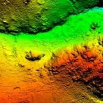
Accuracy is best measured by statistical methods, such as the RMSE (Root Mean Squared Error) which measures the difference between points on a generated model and its respective true points on the Earth’s surface.
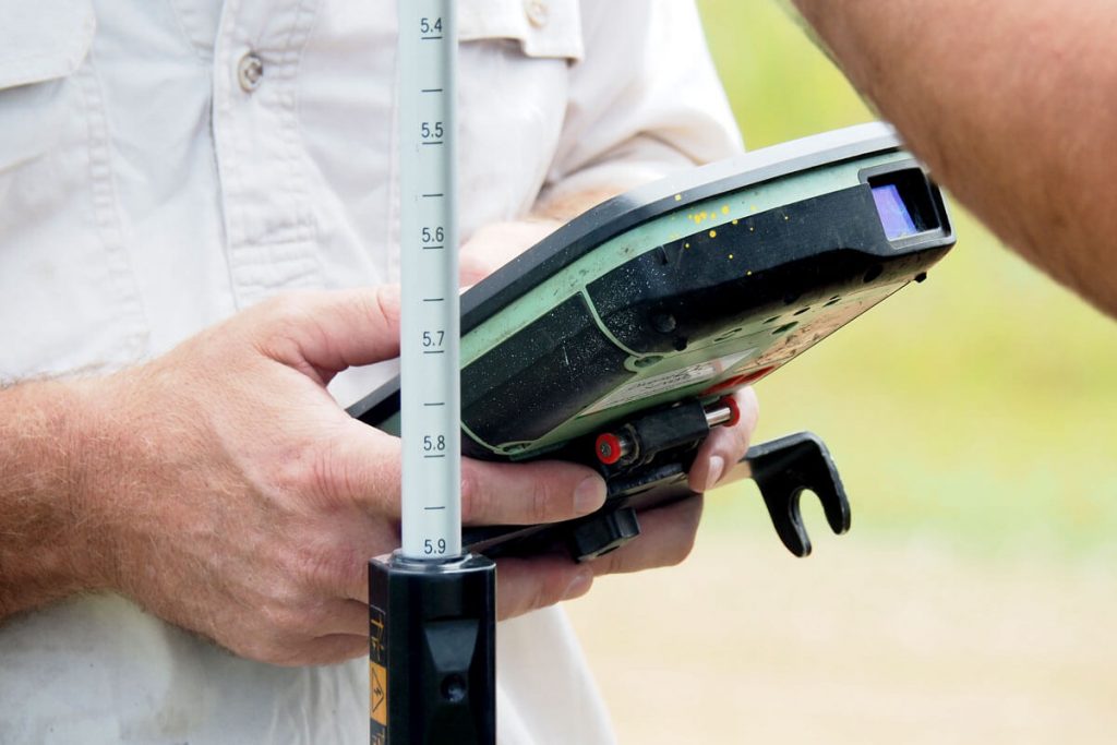
The only way to effectively measure the accuracy and quality of data is by using evenly distributed independent Check Points (not used in the production of the model) measured with high quality GNSS systems.
Accuracy can also be measured in two different ways – Relative or Absolute.
Relative accuracy describes how accurately the points within a model are represented in relation to each other- i.e. if a path width measures 1.5m in real life, the path width on the model should measure the same (or within specified limits) for it to be considered relatively accurate, whether the model is located accurately on the Earth or not.
Absolute accuracy describes how accurate a generated model is in comparison to its known points on earth – i.e. if an object on the path is positioned at certain Lat/Long coordinates when measured with a GPS on the ground, it’s corresponding point on the model should measure the same position (or within specified limits) for it to be considered absolutely accurate – meaning the model is located accurately on the Earth.
Drone surveying (especially using RTK methods) may produce results with high relative accuracy, but a very precise location of the base station is required to ensure absolute accuracy as well.
So, what factors affect accuracy?
There are many factors which impact the level of accuracy, but these are the most common:
Altitude & Overlap – Lower altitude means higher image resolution, but this can be problematic if there are not enough GCPs for each image to capture at least one.
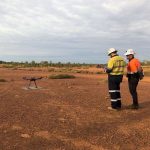
Ground Control Points (GCPs) – quantity, quality and distribution are all important for accurately ‘tying’ the model into its correct position.
Nature of the terrain – Hard/flat surfaces usually have highest accuracies while Homogenous/reflective surfaces such as dense vegetation and water are difficult to map with photogrammetry and can produce erroneous results.
GNSS Systems – Reliable and high-quality equipment is required to measure accurate positions (both on the ground and in-flight). RTK/PPK methods are known to improve accuracy, but they can be complex to understand and operate.
Lighting & Image Resolution – In photogrammetry, measurements are based off the photos captured. Low resolution and/or poor lighting can make it difficult to identify features, leading to increased error.
How can we optimise accuracy?
There are trade-offs between accuracy, efficiency and time.
To achieve the highest accuracies, we would need higher resolution imagery by flying at lower altitudes which means longer flight times and more GCPs required. This leads to an increased quantity (and size) of images, which takes longer to process.
If lower accuracy is acceptable, we could fly at higher altitudes, and have fewer GCPs and less images which significantly reduces fieldwork and processing time.
Every project is different, and there is no standard or measurement for what constitutes high accuracy or ‘survey-grade’ accuracy – it must be defined depending on the objectives. For example, a survey of an area to design a 100m-long pathway may require 5cm accuracy, while the design for a 100km-long road may only require 50cm accuracy. Even though one is 10 times more accurate than the other, both may be considered highly accurate or ‘survey grade’.
Therefore, it is important to understand the level of accuracy required before beginning a project to determine the best approach to fieldwork and processing.
Contact us today to learn more.