LiDAR or Photogrammetry?
Point clouds provide a valuable dataset that spatial professionals rely on in their daily work. In most cases, they are generated using either laser scanning or photogrammetric methods. While these methods create very similar looking datasets, they are in fact very different and it helps to understand these differences when it comes to applying the best method to the problems we are trying to solve.

LiDAR Point Clouds
The term LiDAR is an acronym for Light Detection And Ranging and it refers to sensors used to capture point clouds from both static and mobile methods.
In simple terms, a LiDAR sensor works by sending light (laser) pulses and measuring the direction they are sent along with the time it takes for the pulse to return when it is reflected by an object.
If the position of the sensor (position and orientation) is known, it can be combined with the pulses and return data to create a geo-referenced 3D point cloud of the terrain, vegetation and structures (buildings, powerlines) in the area scanned.
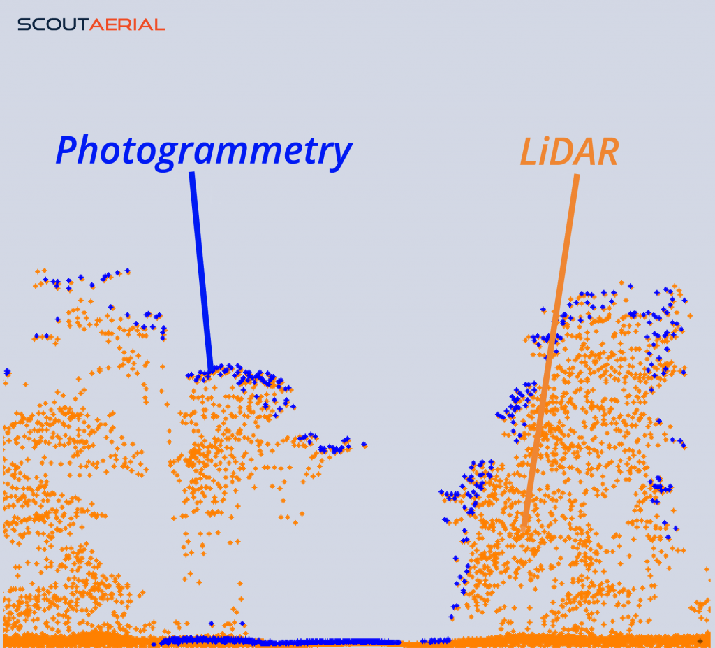
These point clouds are are highly detailed and have point densities typically ranging between 1 to 30 ppsqm (points per square meter). They include additional details for each pulse return, such as intensity and whether more than one return was received from a pulse.
Analysing this information allows the point cloud to be classified as ground, vegetation, building points. Because the pulses are able to make it through gaps in tree canopies, we can identify these points and classify them as ground points. This is perhaps one of the most important characteristics of LiDAR point cloud data.
These characteristics are a result of highly complex and accurate sensors which are very expensive and require a high level of expertise to operate.
Photogrammetric Point Clouds
Photogrammetry is the science of measurement using photography. Click here to read a recent post that provides a great overview.
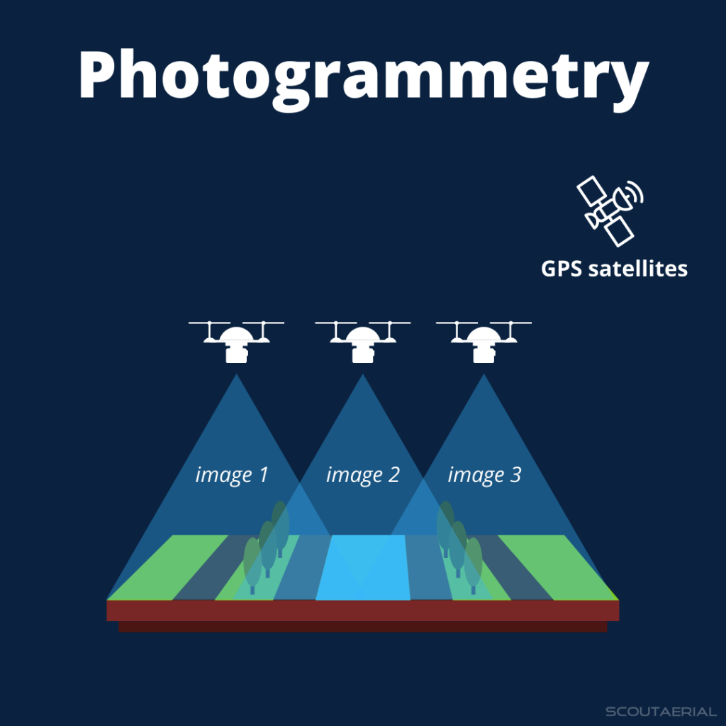
The method most commonly used to generate photogrammetric point clouds is based on the ‘Surface from Motion’ concept where photos captured with very high overlap are processed, identifying and matching each pixel in overlapping photos to generate a 3D position of that point.
The density of these point clouds is extremely high with hundreds of points per square meter of a typical result. The great thing about this method is that almost any digital camera can be used to generate a 3D point cloud. While this may be the case, high quality cameras with stable lenses provide the best accuracy and this is what we see being used mostly for aerial survey with drones.
The main characteristic of photogrammetry is that it is totally dependent on being able to have a clear view of the target feature. Where the target feature is obscured, for example, where the terrain needed to be mapped extends under vegetation canopy, we are not likely to get terrain points in that particular area, but rather the vegetation canopy itself will be mapped in densely vegetated areas.
Choosing which method to use
Spatial professionals who are keen to capture a LiDAR dataset with a drone need to weigh up the benefits offered and the cost that comes with expensive LiDAR technology, over photographic methods.

If capturing terrain data under dense tree canopy, calculating vegetation metrics or capturing the catenary of a high voltage powerline is critical to the successful outcome of your project, then LiDAR may be the most suitable and you will need to allow for this in the project budget.
If you are mapping a wide open area for a terrain model, then photogrammetry will be more than adequate for your requirements.
At Scout Aerial, we are committed to providing reliable, accurate and valuable insights using our wide-ranging experience and expertise. We partner with our clients to better understand their context and requirements to produce results that can be trusted and build relationships that last.
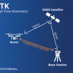
Related Articles: Aerial Surveys by drone, Strengths & Limitations of Photogrammetry, RTK and PPK Drone Surveys
Contact us today to learn more.