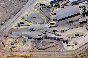
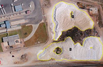
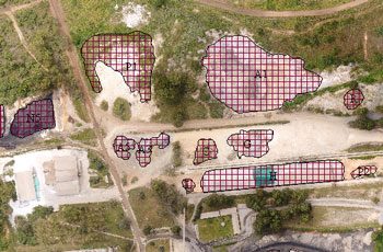
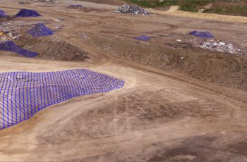
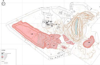
Mining is all about quantities – how much to extract, how much to process, how much is being stored? Having reliable information to make informed decisions is essential for any site manager.
![Stockpile Calculations](https://www.scoutaerial.com.au/wp-content/uploads/2020/10/stockpiles2-350x230.jpg)
![STOCKPILE VOLUMETRICS](https://www.scoutaerial.com.au/wp-content/uploads/2020/10/stockpiles-1-350x230.jpg)
![Stockpile Identification](https://www.scoutaerial.com.au/wp-content/uploads/2020/10/open-stockpiles-350x230.jpg)
![Detailed Orthomosaic](https://www.scoutaerial.com.au/wp-content/uploads/2017/01/aerial_survey_mining_hero-350x230.png)
![Site Map](https://www.scoutaerial.com.au/wp-content/uploads/2020/10/mining_volumes-350x230.jpg)
![3D Volumetrics](https://www.scoutaerial.com.au/wp-content/uploads/2017/11/scoutaerial-mining_3-350x230.jpg)
![scoutaerial-mining-casestudy](https://www.scoutaerial.com.au/wp-content/uploads/2017/01/scoutaerial-mining-casestudy-350x230.jpg)
![Tailings Dam Measurements](https://www.scoutaerial.com.au/wp-content/uploads/2020/10/tailings-dam-350x230.jpg)
![Extraction & Dump Analysis](https://www.scoutaerial.com.au/wp-content/uploads/2020/10/pit-350x230.jpg)
![Extraction & Dump Analysis](https://www.scoutaerial.com.au/wp-content/uploads/2020/10/dump-350x230.jpg)
![Topographic Plan](https://www.scoutaerial.com.au/wp-content/uploads/2020/10/topo-plan-350x230.jpg)
![Stockpile Calculation](https://www.scoutaerial.com.au/wp-content/uploads/2020/10/figure-2-stockpiles-350x230.jpg)
CHALLENGES
- Difficulty managing production to meet demand without accurate info on the level of stockpiles
- Either too much material being processed (and then needing storage) or not enough available to fill orders.
SOLUTIONS
- Manage production and control stock levels with regular measurements of stockpile volumes.
- Centimetre-accurate 3D models and georeferenced orthophotos for measurement and analysis
- Safe, quick and cost-effective data capture using drones and ground control with minimal disruption to operations
- Generate high-res orthophoto, digital surface models and volumetric reports
BENEFITS
- Quicker, safer and a fraction of the cost of using traditional methods of measurement
- Capture data in hours, not days without sending someone to walk up and down dangerous piles resulting in improved productivity and safety
- The precise digital surface area captured by the drone produces significantly more data points in comparison to a ground-based survey, resulting in more accurate calculations
- In conjunction with ground control, we can achieve surveys with 20-50mm accuracy,
- The ability to visualise the data and use accurate information results in better forecasting, decision-making, planning and inventory reporting.
Related Use Cases:
![](https://www.scoutaerial.com.au/wp-content/uploads/2017/12/landfill_volumetric_assessment_1-150x150.jpg)
Landfill Surveys
Keeping track of landfill capacity is essential to making informed decisions on maximising capacity of the site.
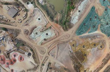
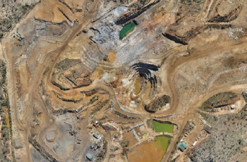
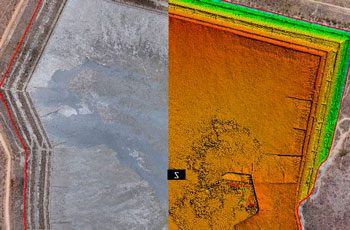
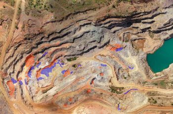
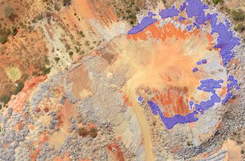
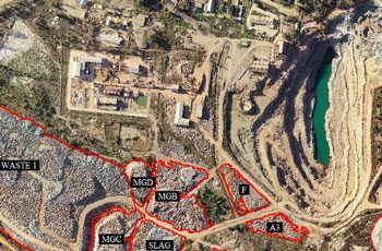
![](https://www.scoutaerial.com.au/wp-content/uploads/2018/11/3bilboesplanning-150x150.jpg)
Mine Management
Leveraging drones can dramatically reduce expensive and time-consuming activities required to manage mine sites.
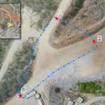
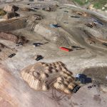
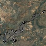
![](https://www.scoutaerial.com.au/wp-content/uploads/2020/10/lineofsight-150x150.jpg)
Traffic Planning
Traffic management on mine sites is essential in reducing risk to workers and visitors.
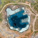
![](https://www.scoutaerial.com.au/wp-content/uploads/2020/10/bathymetric-plan-1-150x150.jpg)
Bathymetric Surveys
Using sonar sensors, we conduct bathymetric surveys to map underwater features and measure depths.