Strengths and limitations of LiDAR
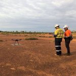
What is LiDAR?
LiDAR stands for Light Detection and Ranging. It is a remote sensing method of using light beams to measure locations of objects on the earth’s surface. LiDAR systems may be installed on manned aircraft or drones (airborne/aerial) or on moving vehicles or stationary tripods on the ground (terrestrial).
How does it work?
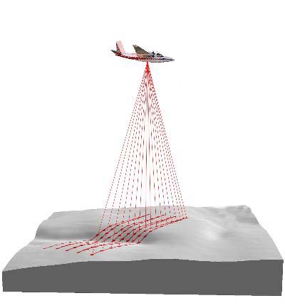
- A LiDAR system emits light from a rapidly firing laser, bouncing back off the surfaces it hits (bare earth, trees, buildings etc).
- A sensor measures the distance travelled by the returned beams to calculate their 3D location on the earth’s surface.
- This data is used to create accurate representations of the surface or terrain scanned, providing valuable spatial data for a number of applications.
What is it used for?
- To generate digital models of the earth’s surface and accurate topographic maps for planning, construction, engineering design, environmental management etc.
- To measure distances, heights, areas, volumes and quantities
+ Strengths of drone LiDAR
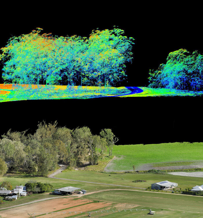
- Quantity and spread of laser pulses allows penetration through vegetation, providing surface data beneath the canopy
- Highly accurate and consistent results (provided the equipment used is of high quality)
- Large areas scanned in a short time compared with terrestrial methods which are highly labour intensive
- Quicker and a fraction of the cost to mobilise and operate compared with manned aircraft LiDAR
- Ability to capture data in remote, unsafe or difficult to access locations, lowering safety risks
– Limitations of drone LiDAR
- Much larger investment into equipment (compared with other technologies) so although economical when used on large scales, it can be expensive for capturing data in smaller areas
- Accuracy is highly dependent on the quality and calibration of the system’s scanner, IMU and GNSS components
- In some cases where vegetation is very dense, the pulses may not be able to reach the ground beneath the canopy
- Its complexity requires a deep understanding of the technology and skills to process the data and recognise inconsistencies or inaccuracies
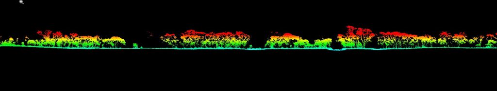
- Typically LiDAR data is not colourised making it difficult to interpret without overlaying RGB photos. Point clouds are sparse compared with photogrammetry, giving a general sense of shape but not a lot of contextual detail.
Why is it useful?
- Infrastructure planning and design
- Drainage analysis and flood mapping
- Environmental monitoring
- Volume calculations of stockpiles and landfill
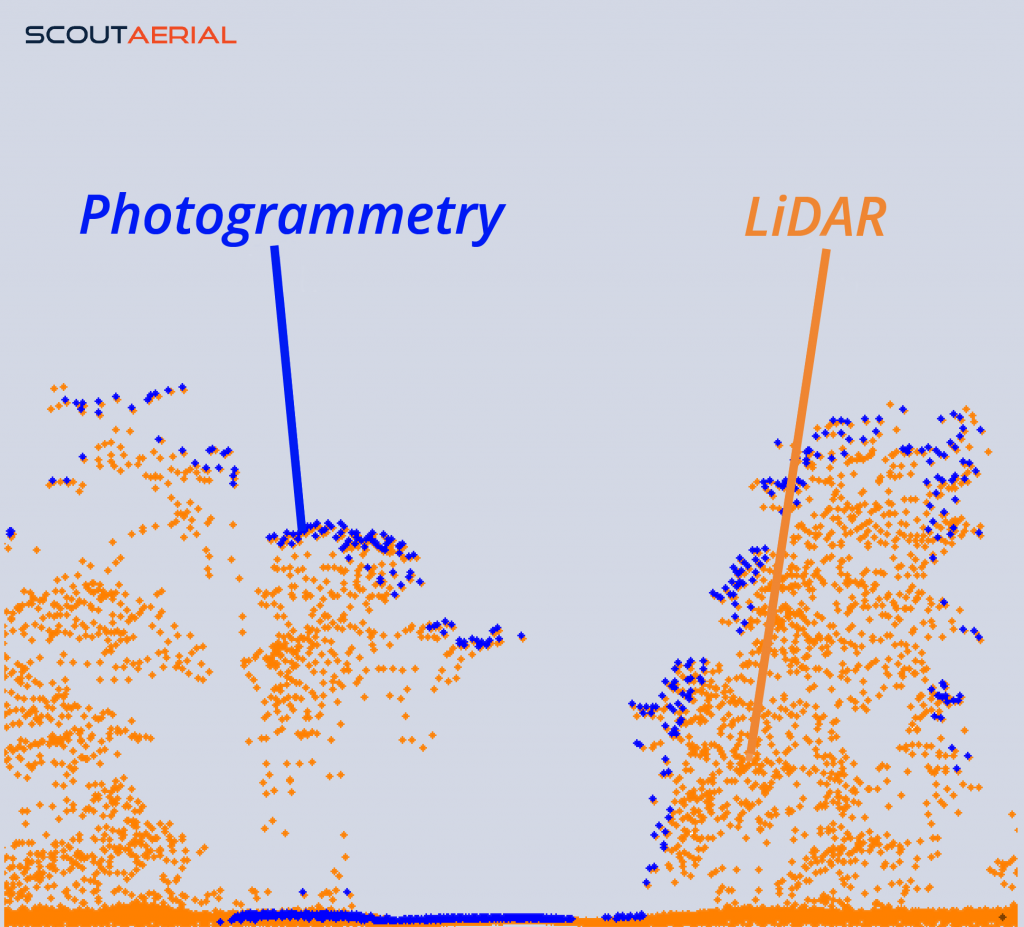
Comparison between LiDAR and Photogrammetry’s ability to capture the surface beneath vegetation.
Notice the dense ground surface (blue) is only generated in areas where there are gaps in the canopy whereas LiDAR can produce a consistent ground surface (orange) beneath almost all of the vegetation.
How do you know when you need LiDAR over other methods?
Traditionally, LiDAR capture required the use of manned aircraft which carries significant operational costs but now that we can use drones it offers a more cost-effective method and reduces the inherent risks involved in operating full sized aircraft. For most projects, accurate surface models are achievable with standard aerial drone surveys using photogrammetry which is not only more cost-effective, but can also be more forgiving than LiDAR. Photorealistic outputs can be produced at high levels of accuracy, point clouds are dense and general processing is relatively quick (with much of it automated).
However, LiDAR is much better suited for vegetated areas as it can provide ground detail under the canopy – which simply cannot be achieved with photogrammetry. If your project features areas of vegetation for which you require a terrain model beneath, then LiDAR really is the only option to achieve this. LiDAR is also better at capturing finer objects such as powerlines. And for larger areas (over 500ha), LiDAR is a more efficient way to capture the data since the sheer volume of photos required for photogrammetric mapping makes it longer and more cumbersome to process.
A final word of advice:
Like anything, LiDAR has many advantages when used correctly, but understanding its strengths and limitations is essential to recognising when it is well suited for the requirements of a project or if an alternative method is more appropriate.
What a lot of people aren’t fully aware of is the effect of a LiDAR system’s quality of components in producing reliable data. The scanner, IMU and GNSS must be of high quality and calibrated with precision to ensure accurate outputs. Many LiDAR technologies are designed for terrestrial applications (such as autonomous vehicles) to capture small objects in a short range which is very different to the requirements of a survey-grade aerial LiDAR system which is purpose built to collect highly accurate topographic data. There are very few manufacturers of these in comparison to those repurposing automotive or industrial scanners for use on drones. Systems can range in cost from $15,000 to $300,000+ and the difference in outputs is immense. That’s not to say the lower-end options are not useful, it just depends what you are trying to achieve. So when you see the word LiDAR, don’t assume it’s all the same! Do your research to ensure it is fit for your purposes.
We use the industry leading Riegl MiniVux3 lidar scanner integrated with RGB cameras which produce a fully colourised 3D pointcloud and orthomosaic from the same dataset and we are consistently achieving accuracies between 20-35mm. For more information on our LiDAR capabilities, learn more here.
At Scout Aerial, we are committed to providing reliable, accurate and valuable insights using our wide-ranging experience and expertise. We partner with our clients to better understand their context and requirements to produce results that can be trusted and build relationships that last.
Related Articles: Aerial Surveys by drone, LiDAR or Photogrammetry?, Strengths and Limitations of Photogrammetry
Contact us today to learn more.
References: Image Credit