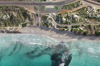
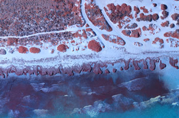
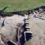
Gathering accurate, actionable environmental information is essential for making more informed decisions that protect people and nature.

We have a wide range of environmental monitoring capabilities including tracking erosion, monitoring rehabilitation, assessing damage from natural disasters, biodiversity counts and performing long-range surveillance operations. 

Using a range of sensors available and without putting people at risk, we are able to capture accurate representations of the environment for actionable insights. Often these environments are difficult or dangerous to access on the ground so it is much safer to gather the data remotely.  

Scout Aerial is certified, compliant and fully insured. 

Useful for:

  • Change detection and trend analysis
  • Erosion mapping, modelling and tracking
  • Monitoring deformation
  • Monitoring rehabilitation progress
  • Monitoring invasive species
  • Flood and water pooling simulation
  • Sediment movement studies
  • Coastline modelling for monitoring erosion
  • Tidal data and monitoring
  • Canal management mapping
  • Road resurfacing calculations
  • Power line monitoring
  • Pipeline monitoring
  • Fume monitoring & Gas detection
  • Damage Assessments – Fire, Flood, Storms 
  • Biodiversity monitoring and counts
  • Surveillance to detect illegal activities

Key Benefits

Powerful Insights

Flood Mapping

Monitoring Deformation

Erosion Monitoring

EROSION MONITORING

Weed Volumetrics

Near Infrared (NIR) Analysis

Weed Mapping

Tree Counts

Forestry Assessment

Tree Health Assessment

Rehabilitation Monitoring

Gas Detection

scoutaerial-survey-gas-collection

Fire Detection

FIRE DETECTION

Shark Detection

shark-detect

Use Cases

Erosion Monitoring

Monitoring erosion along shorelines and seawalls is essential to ensuring the safety of local dwellers.

scoutaerial-paralax-agri

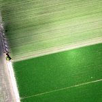
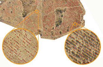
Precision Agriculture

Multispectral sensors are used to assess crop health, identify disease, monitor drainage, and more. 

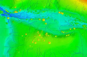
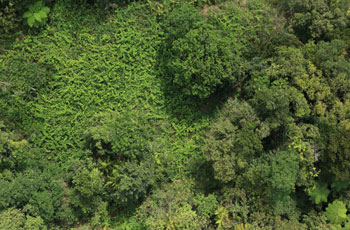
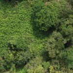
Forestry Assessments

Aerial data provides a wealth of information on yield, growth rates, fire damage and harvest expectations.
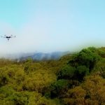
Fire Detection

The system senses bushfire smoke to provide an early warning signal to minimise the impact of bushfires.
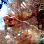
scoutaerial-survey-forensics

Forensic Detection

Detection of anomalies in soils and ground cover which could identify unknown grave sites. 
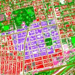
scoutaerial-land-cover-harare-city-centre

Land Cover Mapping

Capture valuable data for classifying land cover and use for planning, monitoring and policy-making.
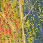
Weed Mapping

Control of weed growth is crucial to maintaining productivity gains and sustainable herbicide use. 
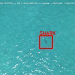
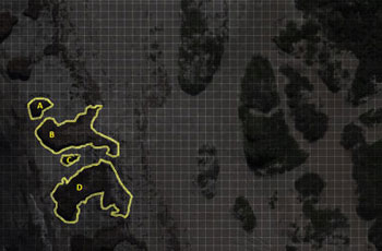
Shark Detection

Aerial surveillance with machine learning technology for early detection of sharks at popular swimming beaches.
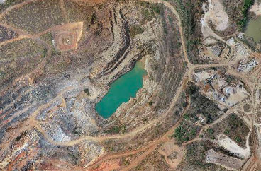
scoutaerial-survey-gas-collection

Gas Detection

Assessment of gas concentrations shortly after a blast for improved safety and environmental purposes. 

Contact us today to discuss your requirements.